Zürich's tram route 6
All pictures can be enlarged by clicking on them.
 Zürich’s tram route 6 is certainly one of the city’s most remarkable tram rides. Rising from the city centre, at about 400 metres above sea level, to the Zürichberg, at about 600 metres in a series of serpentine curves – some of them affording panoramic views over the city and lake – this is a ride that no visitor should miss.
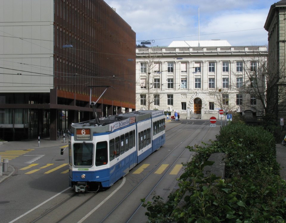
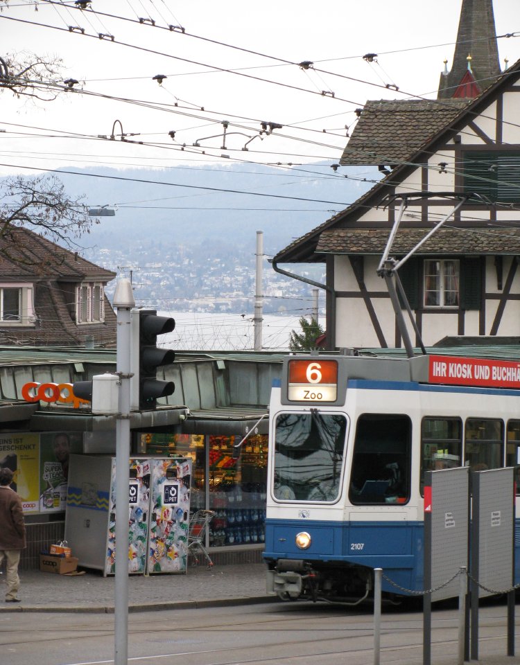
 Our journey begins in the Bahnhofstrasse, one of Europe’s most prestigious shopping streets. Trams of different routes run within metres of exquisite shop windows and the occasional street café. However we are leaving this world of big money and illusion behind us for a more affordable form of pleasure, and one that is more genuinely typical to Zürich. During much of the day, route 6 actually starts at Enge and has already crossed the town by the time it gets here. However, for now we will concentrate on the hill climbing section that makes route 6 so special.
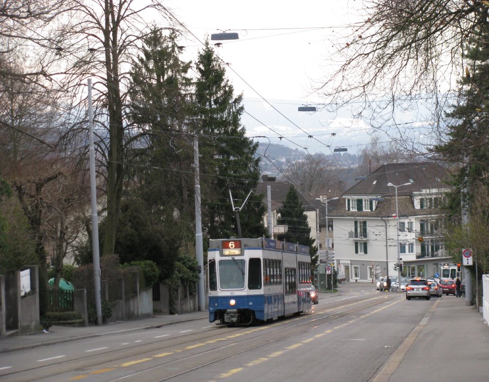
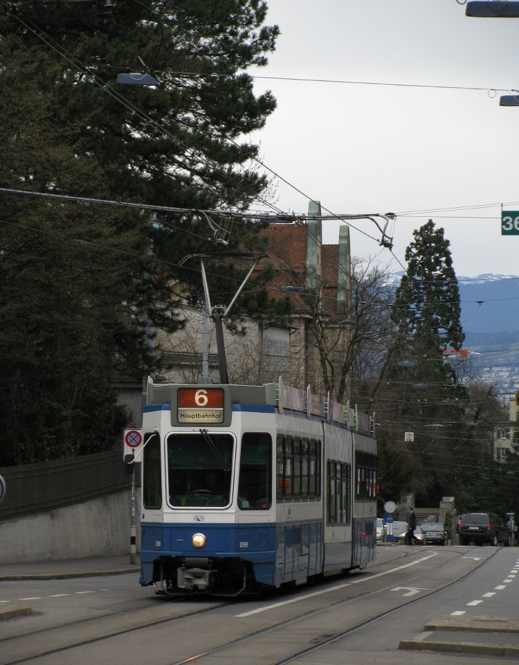
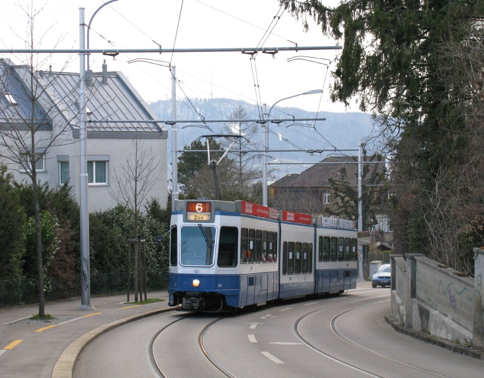
 Our tram arrives. It is probably a so-called Sänfte. These trams, numbered 2099-2121 are the newest of the Tram 2000 family, delivered in the early 1990s and converted to low-floor through the insertion of a centre section in the mid 2000s.
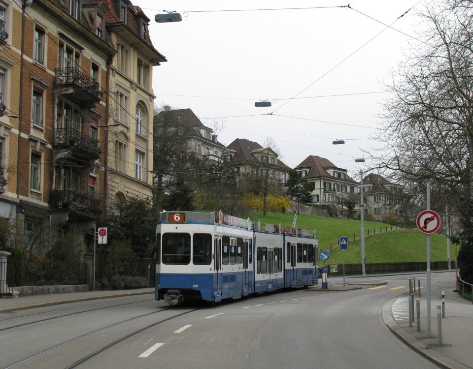
Leaving the Bahnhofstrasse, the tram turns right and follows a busy four-track layout, with a seemingly endless stream of trams coming from several directions at once. Our tram probably stops to let some of these pass before rolling across the river bridge and reaching Central stop.
 It is here that the climb starts. No sooner has the tram left the stop than it is tackling the first of many gradients. Very soon we have reached Haldenegg, the first of the line’s hairpin curves. The alignment here has been eased over the years and the roadway widened by carving into the steep hillside, but when this line was first built, space was so tight that the connection could only be mastered through a switchback.
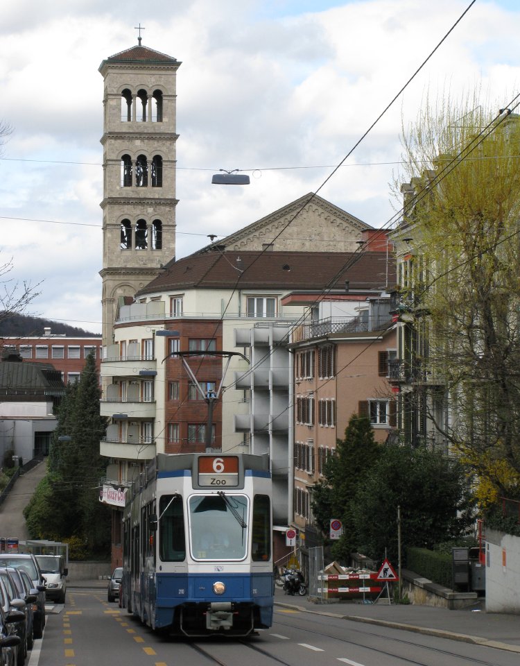 Towering high above this curve is the slim and elegant tower of the 19th Century Liebfrauenkirche. This is actually a copy of the Basilica di San Paolo fuori le Mura in Rome, adding a touch of Italian style to this part of town and the tram ride.
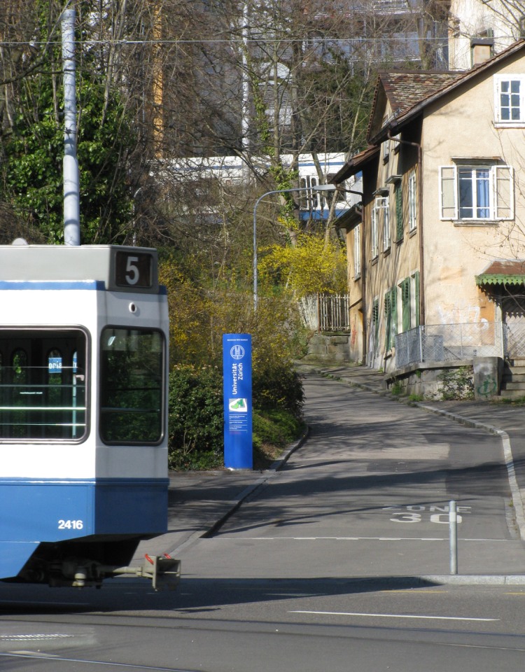
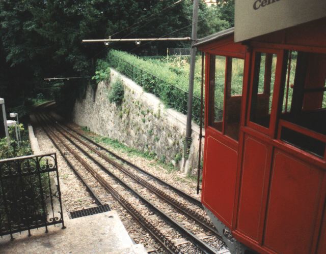 At the next curve, we pass on our right the upper station of the Polybahn funicular. Visitors to the Swiss Alps may well have travelled on one of the ascents that have to be taken in sections. Maybe one cog railway, funicular or cable car connects with another, each adjusted to its particular itinerary, with the various sections maybe being added over a space of very many years. Prior to 1906 the journey we are currently making would have involved something similar. Trams ran down below in the town, and trams ran up here, but to get between the two you would have had the choice between a long detour and this funicular. Until 1996, the Polybahn was still worked by the original cars of 1889, but sadly despite being a tourist attraction in their own right and having an excellent safety record, the authorities decided they needed to be replaced by rather unconvincing copies.
 The gradient levels out again, and the tracks weave their way between the imposing buildings of Zürich’s academic institutions, some of which changed little since the days that Albert Einstein studied here.
 After turning right at a triangle junction, we pass the university hospital, set in a spacious park with many mature and rare trees. This garden was created in the 19th Century when the remnants of the town's outer defences were demolished. When this tram line was built, demolition was still in progress and the trams crossed the narrow gauge railway that was used to remove the spoils in a level crossing. The reason the defences were built here was that the hillside forms a broad natural plateau overlooking the town — hence the name of the tram stop we reach after turning left at the next triangle junction: Platte.
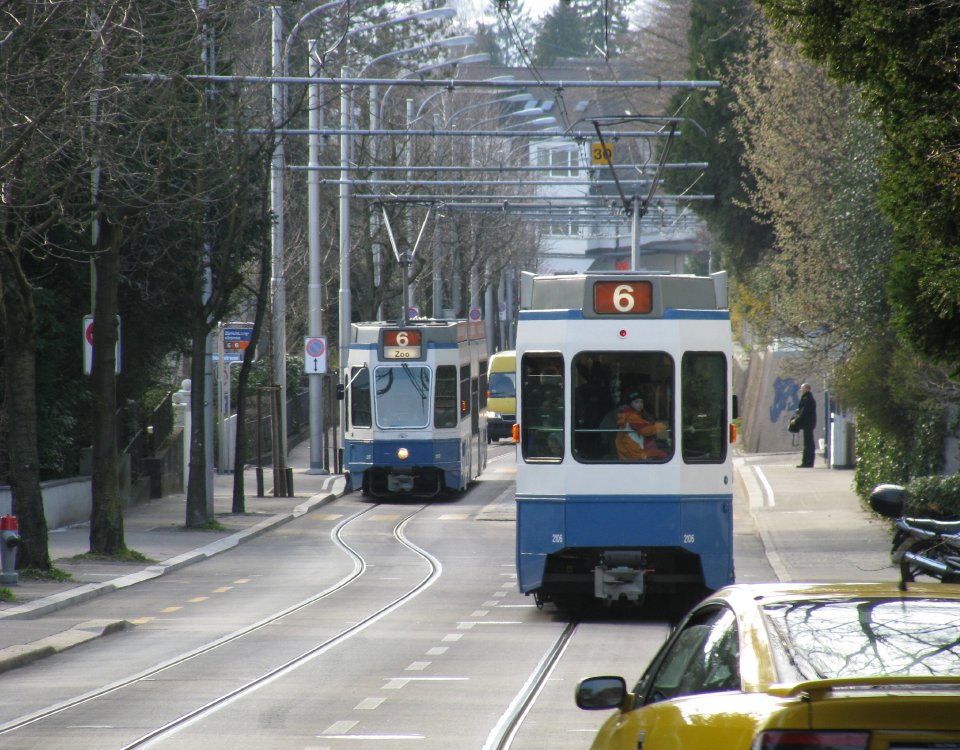
 Our tram once again faces an incline, slight at first, but getting ever steeper. We twist up two further hairpin bends, providing some glimpses of the city far below and the glistening lake. In this view we see two trams at different levels of this climb.
 This view was taken at the higher level visible in the previous picture. The town houses are increasingly giving way to elegant villas. This is the Zürichberg, one of the most sought after residential areas of Zürich.
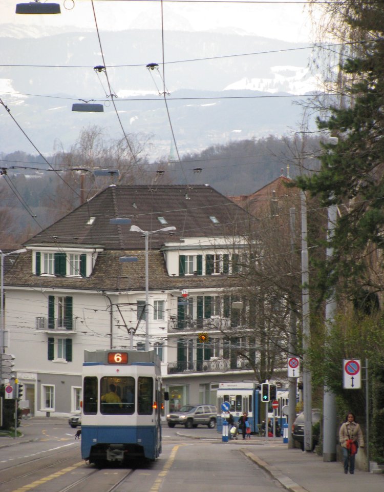
 If we look out of the windows on the right side of the tram, and weather permitting, we catch some views of the snowclad Alps.
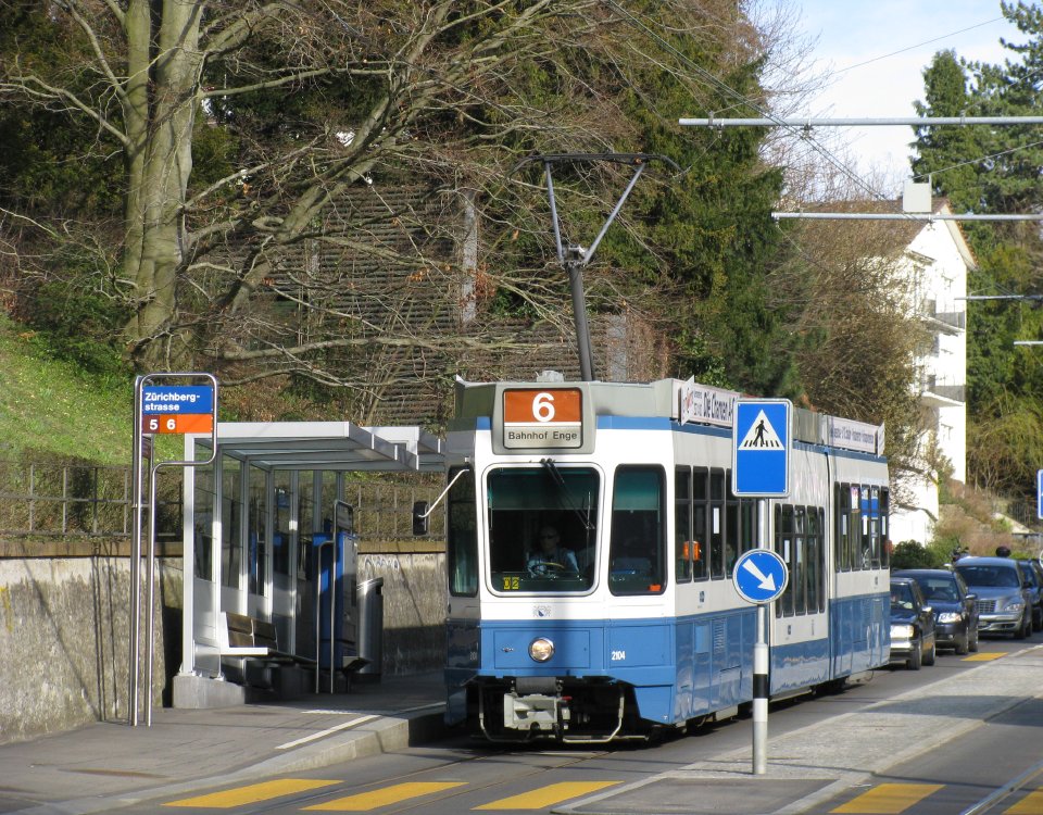
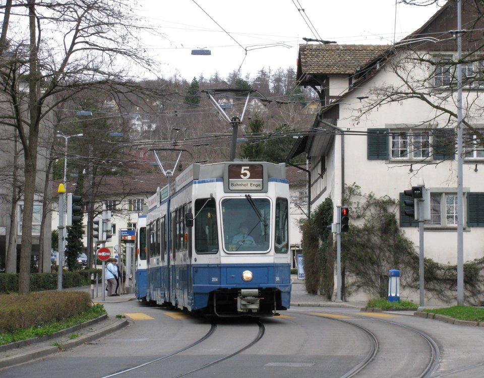 At Kirche Fluntern, we pass the turning circle of route 5. Only on Sundays, when extra trams are needed to help master the rush on the zoo, does route 5 continue beyond here. As some of the semi-timbered houses and the little church dating to the late middle ages suggest, this is what remains of the old village of Fluntern, long since absorbed into the city. It was the villagers of Fluntern who put up much of the capital to build the tram here, not so much in search of return on investment (the old Zentrale Zürichbergbahn never provided a good return on investment), but to increase the value of their real estate — a goal that was most certainly achieved.
 In this shot, we see the tram, the old houses of Fluntern, the church spire and the lake all in one view. The turning circle of route 5 runs around the building in the foreground.
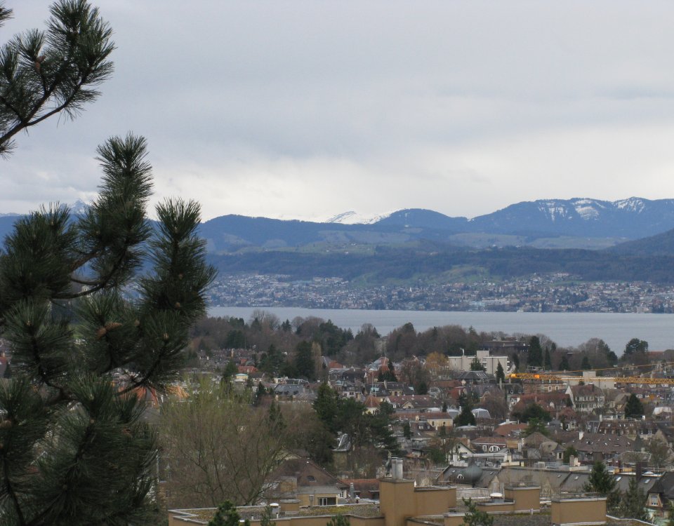
 From Kirche Fluntern there is another steep climb to Toblerplatz. Views such as this one, show how very green the countryside surrounding Zürich appears. This impression is not entirely accurate however, as what we see here are unbuilt hill- and mountaintops. Indeed the conurbation is expansive in the lower-lying areas such as that to the North and West.
 From Toblerplatz we embark on a further ascent up Kräbühlstrasse. This is one of the longest straight sections of the line, but also one of Zürich's steepest, with an incline of about 6%.
 This view shows Susenbergstrasse, the last stop before the Zoo terminus. This section of route has recently been rebuilt providing level boarding for low-floor trams, whilst also providing traffic islands in the middle of the road which act both as traffic calming measures and assure the safety of passengers by preventing cars from overtaking stopped trams.
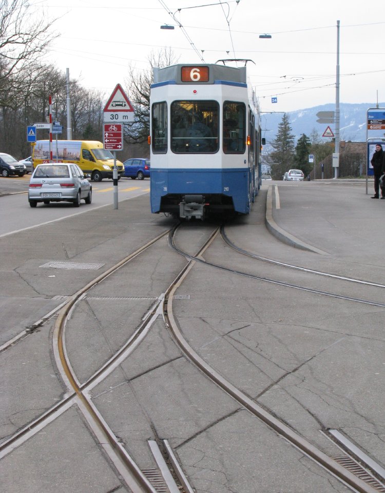
 We take another curve before the final approach to Zoo terminus. In this view the Uetliberg, Zürich's "mountain" (which is climbed by a light railway, by the way, and the foot of which si served by various tram lines) forms the backdrop together with some rather ugly post-neo-contemporary architecture (but don't get me started on that).
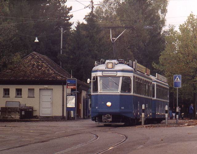 So this is the Zoo terminus. I selected a picture from the past. The Kapfen trams are now in the Ukariane, but the scene has otherwise changed little. The terminus lies on the edge of the forest. The Zoo proper is still a short walk from here. The adjoining cemetery (behind the tram) features the last resting place of James Joyce, who spent many years exiled to Zürich and whose writing immortalised some of its institutions, including the trams. For those of less literary inclination, the FIFA headquarters is but a short walk from here.
 I'll close with another speciality of this line. To prevent parked trams rolling down the steep gradient, the sidings at Zoo terminus were protected by spring-loaded catch points. These views show the marks left in the asphalt left by tram drivers who forgot about this feature. The left-hand track has since been taken out of use and the turnout to the less dangerous right-hand track welded down.
Zürich tram main page
Zürich tram news
Zürich tram pictures
more tram articles
last updated: 03.04.08
counter added: 03.04.08